


Data DownloadsOnTimeZone file types are offered in 3 formats:
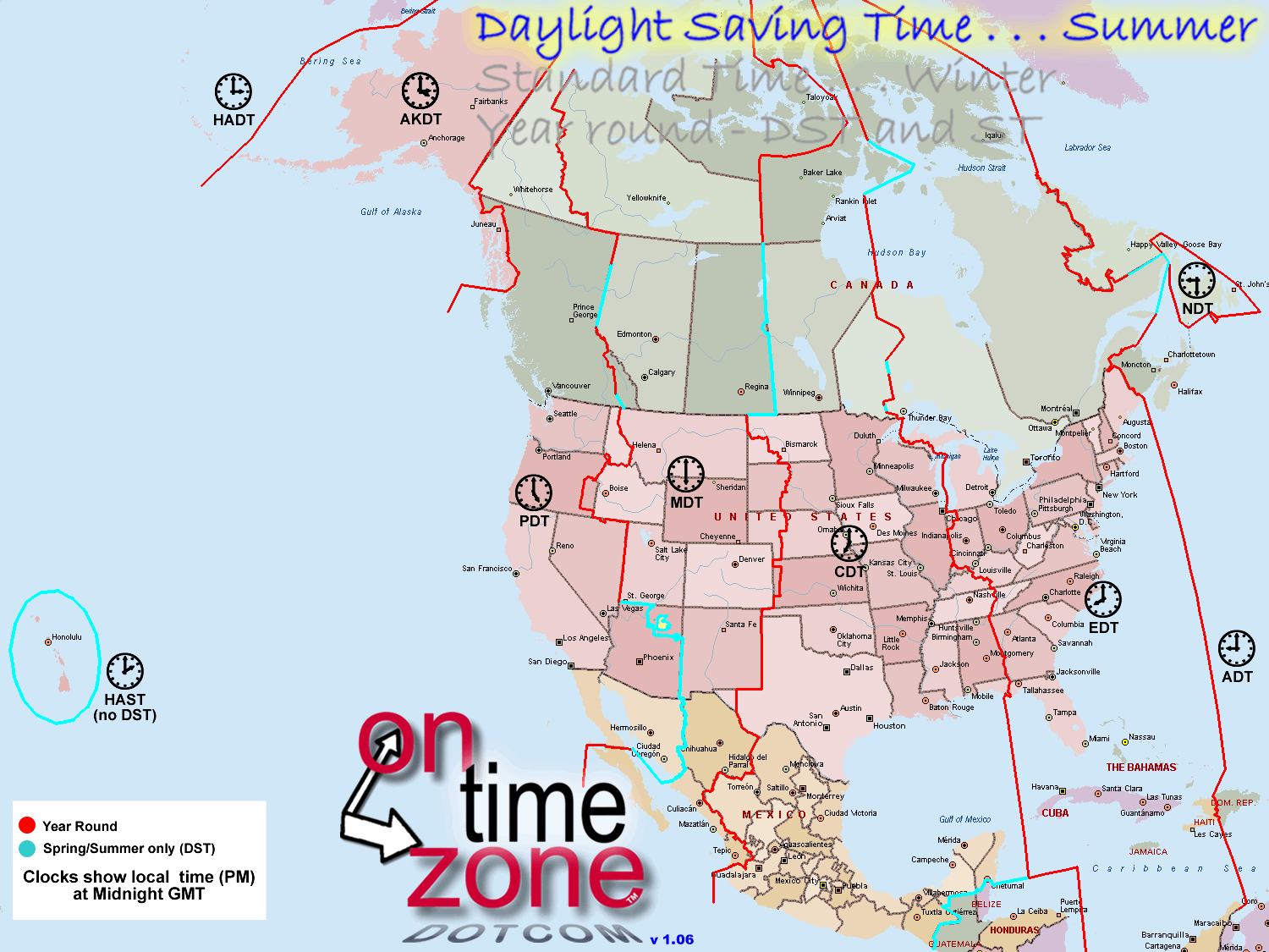
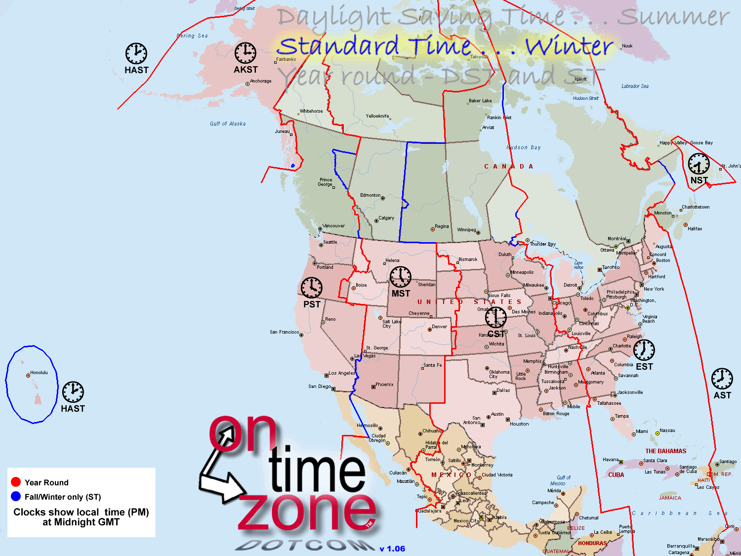
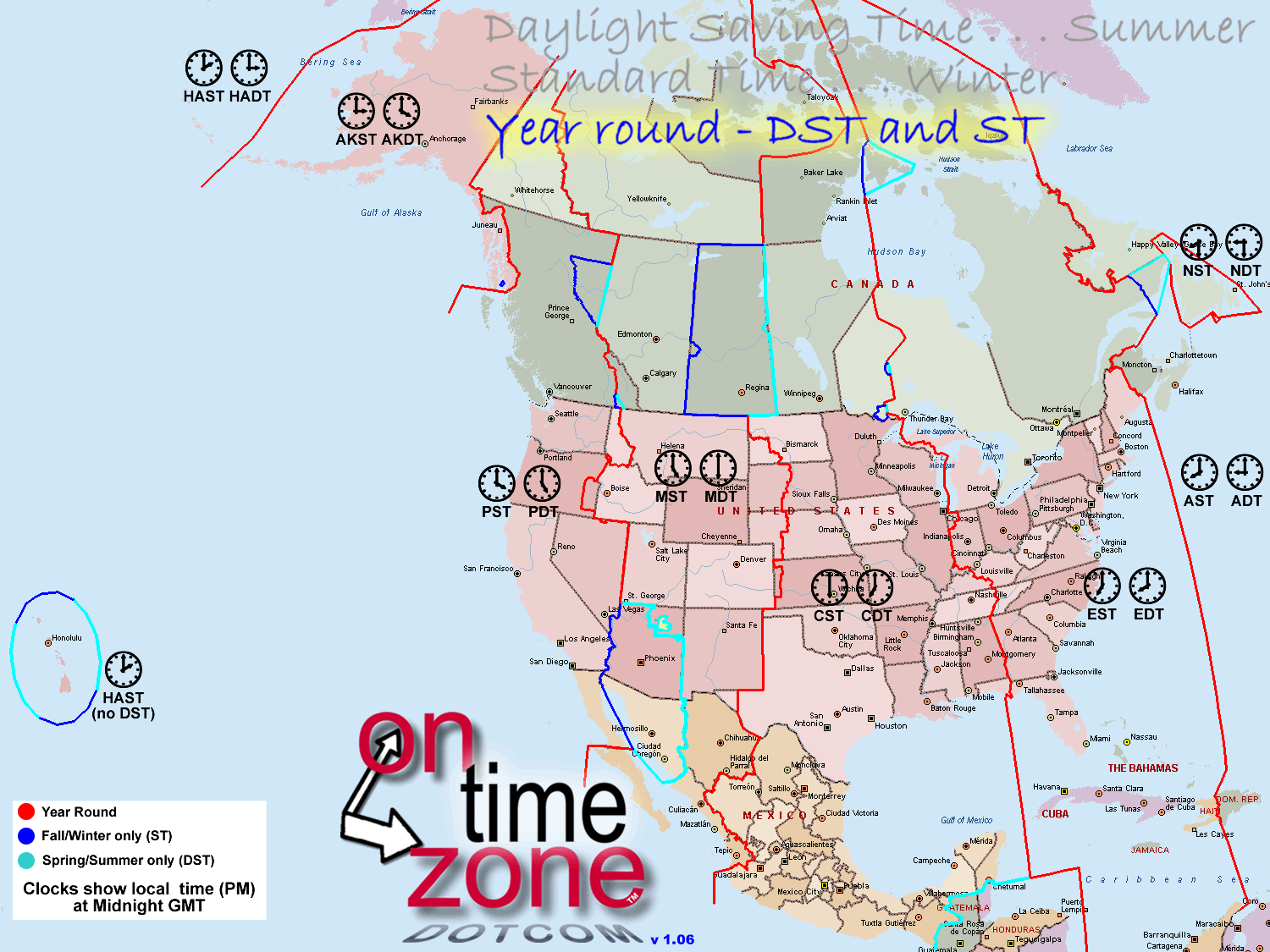
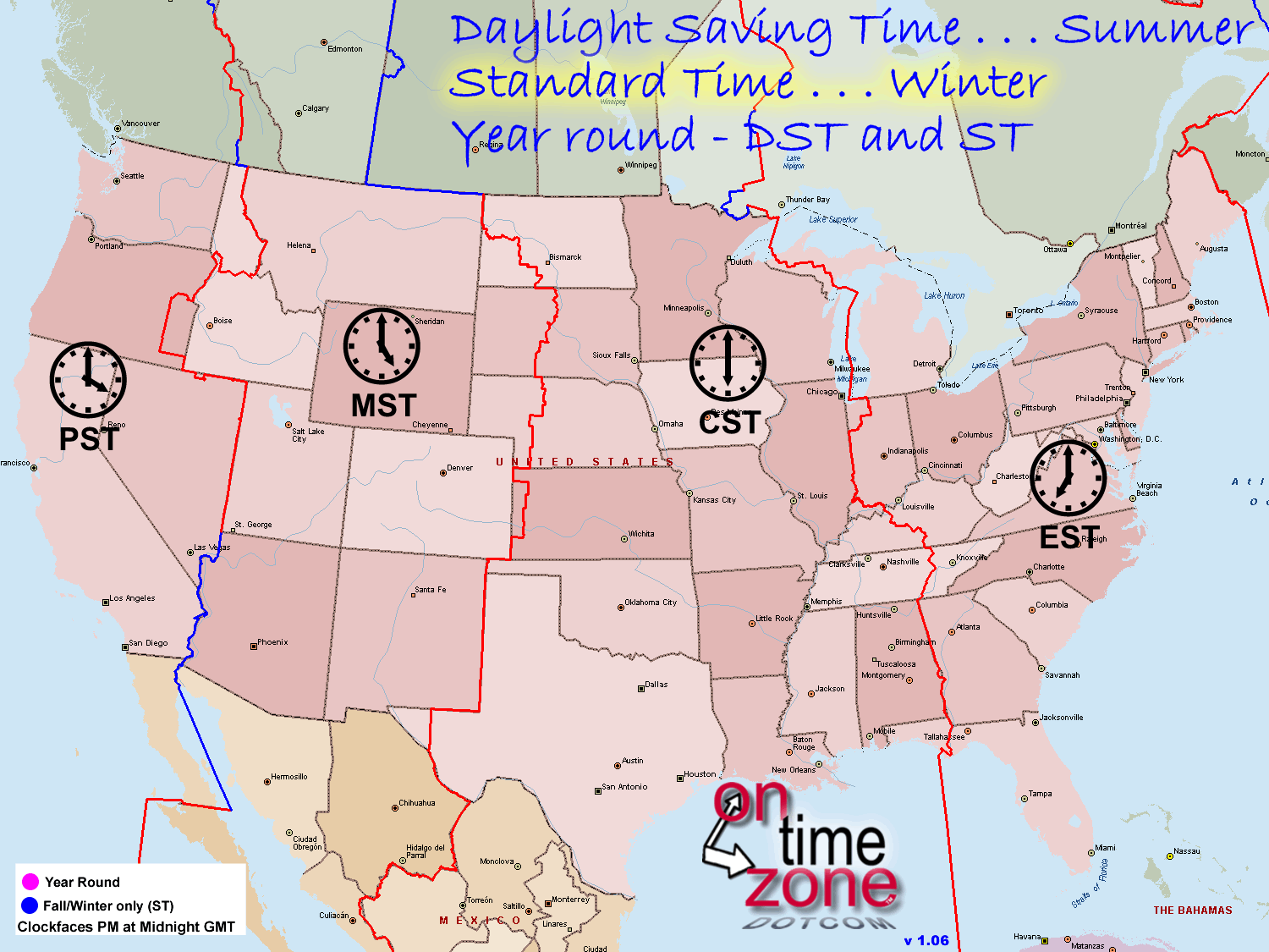
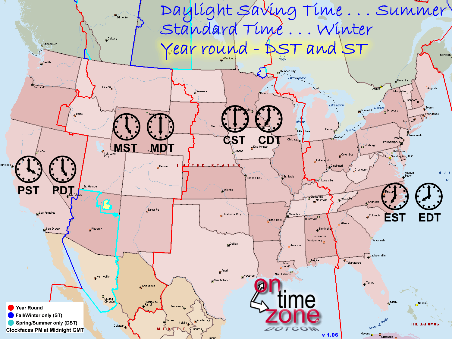
Viewing the different images on the home page will explain the differences between those 3 formats better than any brief description I could type. The combo format can be confusing - the other two formats are easier to use. If you do use the combo files, be aware that each area where there is a variance in Daylight Savings observance is surrounded by blue borders. In DST (summer), light blue borders ( — ) apply. In ST (winter) use the dark blue borders ( — ). Magenta borders ( — ) apply year round. Click or right-click your desired file format to open or download:
"Streets & Trips" data files offered in two versions:Both formats use the same data. They differ only by what version of S&T was used to generate the file. Streets and Trips files are upwards-compatible to a limited degree. Within the ranges described above, you can open an older format with a newer version of Streets and Trips, but the first time will generate a prompt to match records to updated maps. Just say OK, and the automatic upgrade takes place. When you save the file it is formatted to your current S&T version and will open without a prompt next time. S&T versions earlier than 2007 are not supported by OnTimeZone. Streets and Trips users may want to consider using the template version of the time zone data, which allows you the option of automatically including time zone data in any new maps you create. More information about how to use S&T templates can be found here and here (archived copies from the now-defunct S&T blogsite). S&T templates are simple and powerful, and well worth exploring. For detailed information on how to use OTZ data in Streets and Trips click here.
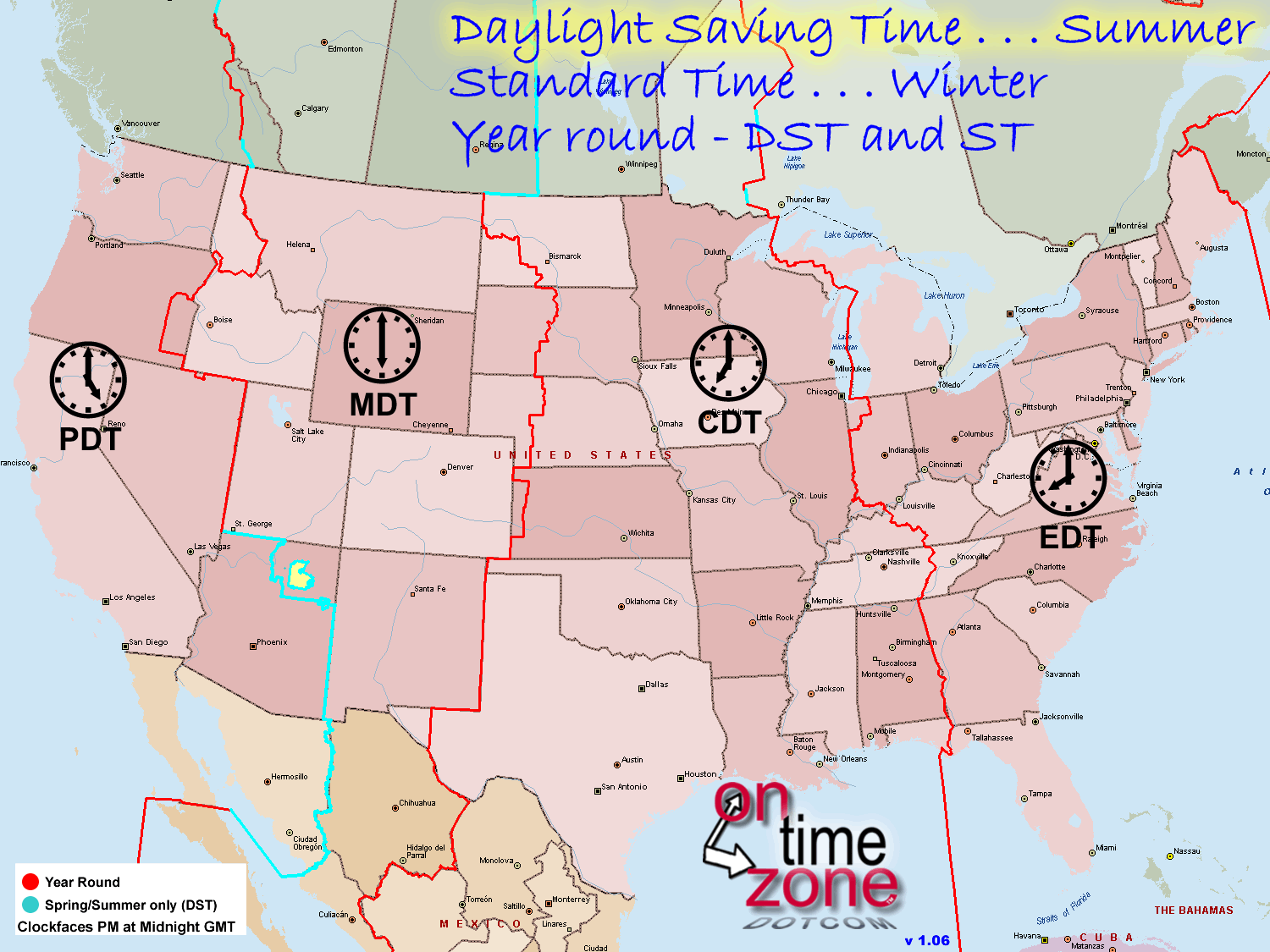
* The clock faces on the print files show the local time in PM when it is Midnight GMT, or AM when it is Noon GMT. ** Possible Problems with GPX files: The GPX file format uses the xml standard. Some browsers and configurations treat it as raw xml data rather than a file, causing a variety of confusing results. If you have any problems at all downloading or opening the GPX file you should instead download and unzip the zip file. It contains the same GPX file, which should open fine for you once you download it. Also, the "Streets and Trips GPX import format" files are specifically formatted only for importing into S&T using the "Import GPX File" data function in S&T v2010 and later. They will not display properly if opened in other tools. For other mapping uses, the "GPX Interchange Format" is what you need. *** Google Earth Users, and those using the Earth plugin with Google Maps may encounter situations where, at very tight zoom levels, portions of some of the time zone borders may disappear. This is a reported bug in Google Earth. I continue to seek a workaround to the problem and will update the files if I find a fix.. It does not appear to be a problem with regular Google Maps. In GPX and GDB format, time zone lines are stored as tracks rather than routes. This prevents your GPS from trying to recalculate them. Track naming conventions:You probably don't need to read this unless you are a programmer planning to use this data in some automated manner. In formats that allow the zone borders to be named (gpx, Garmin, Google Earth/Maps) tracks have been named thusly: Begin with "ST" or "DST" to indicate the time of year they apply, Standard or Daylight Saving time. Then there is a "Z-" followed by the number of hours offset. That is the number of hours to subtract from Greenwich Mean time for this border to get the time on the West, or left side of this border. Normally the time will be 1 hour later on the right (East) side of that border. An exception to that rule is the case where the zone border encircles an area, such as in Newfoundland or Hawaii. In those cases the time offset applies to the area inside the enclosure. When more than one non-fragmented segment (the magenta lines) are necessary to complete a border, the southernmost segement is ended with a number starting with 1, and counting up to the northernmost segment. So a line labeled "DST Z-7 Pacific / Mountain 2 " is (starting from the south) the second of multiple dividing lines between the Pacific and Mountain time zones -- and that during Daylight Saving time, the Pacific time zone is 7 hours before GMT. Fragments of lines end with an "X" followed by the name of the fragment. These lines are used to border the portions of North America do not observe DST, for example "DST Z-07 Pacific / Mountain X Arizona". They are color coded - dark blue for borders that apply in Fall/Winter (Standard time) or light blue for borders that apply in Spring/Summer (Daylight Saving time). Fragments of Official time zone borders begin with "X Official", followed by the name of the fragment and the time zones it divides. For example, "X Official Fort Pierre - Mountain / Central". These fragments appear only in the US, and only in areas where there is unofficial deviation from official time zone borders.
Acknowledgements, Credits and Thanks  © 2010-2026 Steve Jones. All Rights Reserved. DISCLAIMER: All content was generated via human effort. Every attempt is made to ensure accuracy, and any errors detected or reported are corrected. But it is not possible to guarantee 100% accuracy. Therefore the contents of this site are not suitable for any use involving risk to health, finances or property. DO NOT ASSUME ONTIME ZONE BORDERS REFLECT POLITICAL BOUNDARIES. Some political boundaries are complex, with conflicting sources of data and possible ongoing disputes. This is especially true of many Native American lands. OTZ boundaries seek only to show the likely time at a given location, not to indicate anything about the local legal or political authority. Travelers should use other resources to remain mindful of their location when near international boundaries or those of soverign entities, especially those which may be poorly marked or follow geographic features. Though donations are welcome and appreciated, the contents of OnTimeZone.com are unrestricted for any private, non-commercial use. It can be licensed for commercial and government use, contact us at the email address above for details. All rights to content from OnTimeZone.com (files, data, artwork, webpages) are reserved. Content may not be published elsewhere or used for any commercial or governmental purpose without explicit written permission. |
|