


IMPORTANT NOTE: Updates to OnTimeZone.com ended in 2017. While the vast majority of the data remains accurate, it should not be considered a reliable source for current data. For instance, in the Fall of 2022, Mexico ended Daylight Saving Time in most of the country - exceptions being the state of "Baja California", and border municipalities in the states of Chihuahua, Coahuila, Nuevo Leon, and Tamaulipas, which will contiue to mimic the time observance in the US to reflect the strong business ties between adjacent US and Mexican communities. This is just one example.
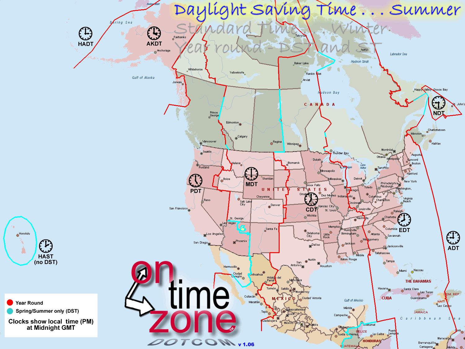
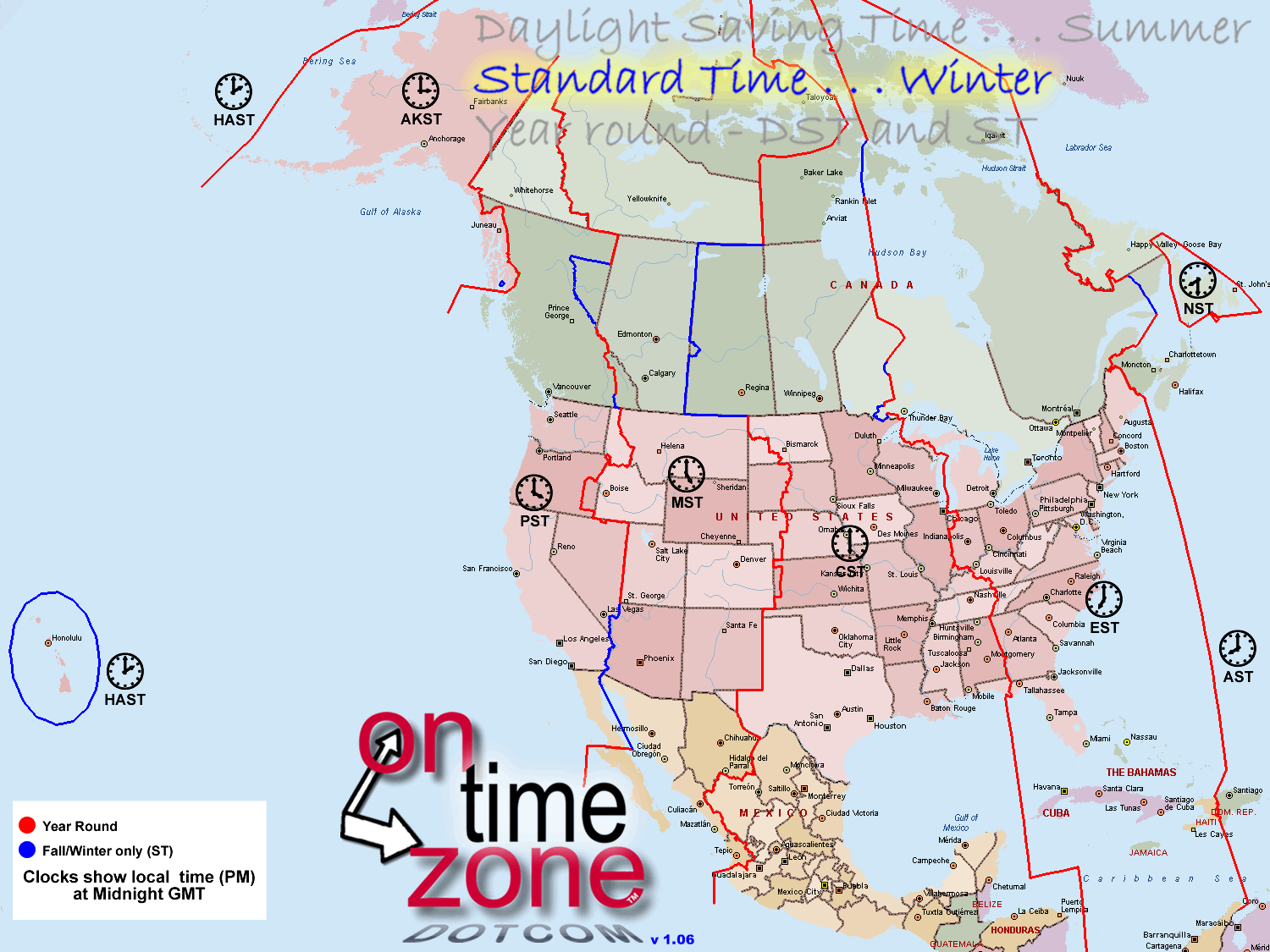
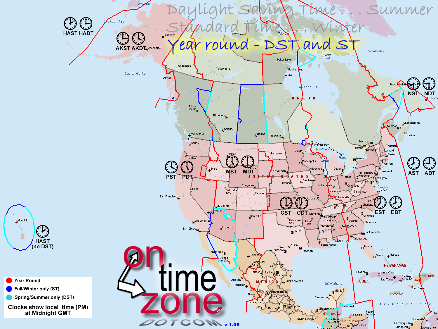
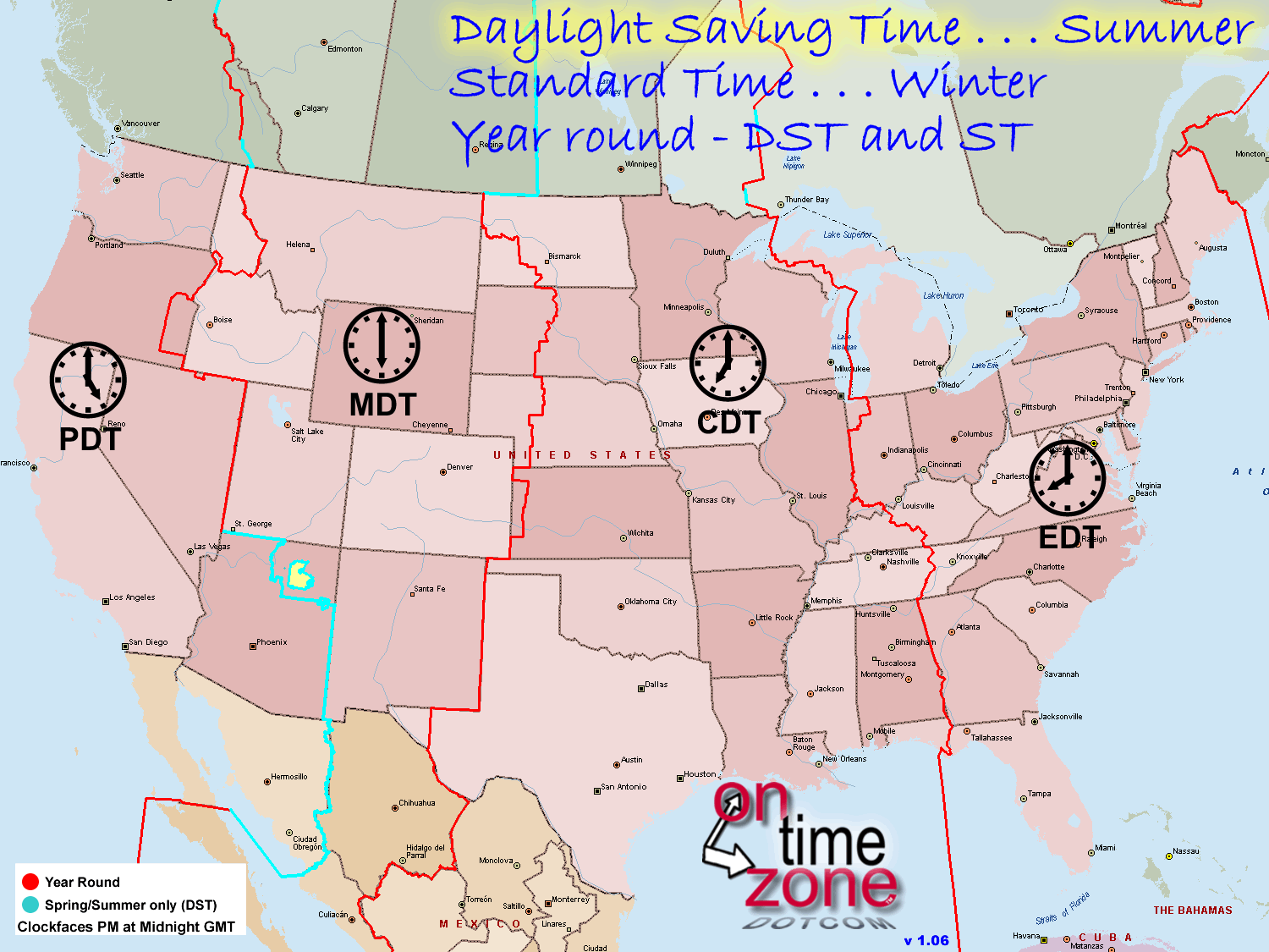
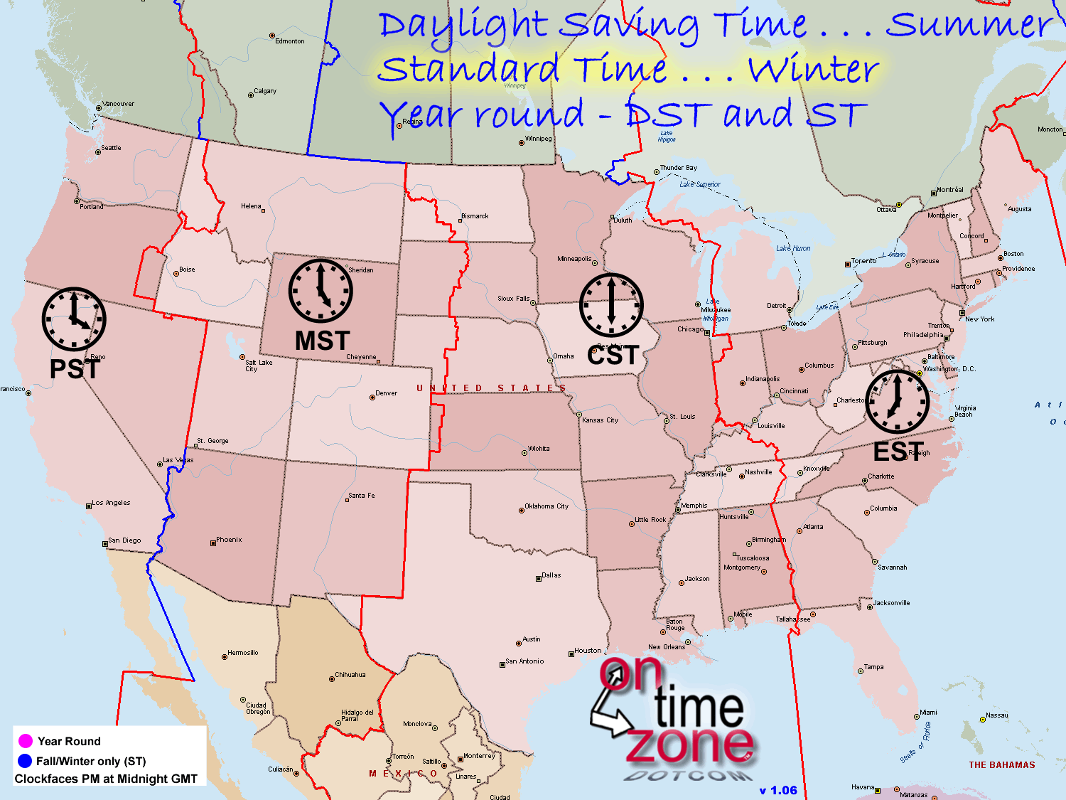
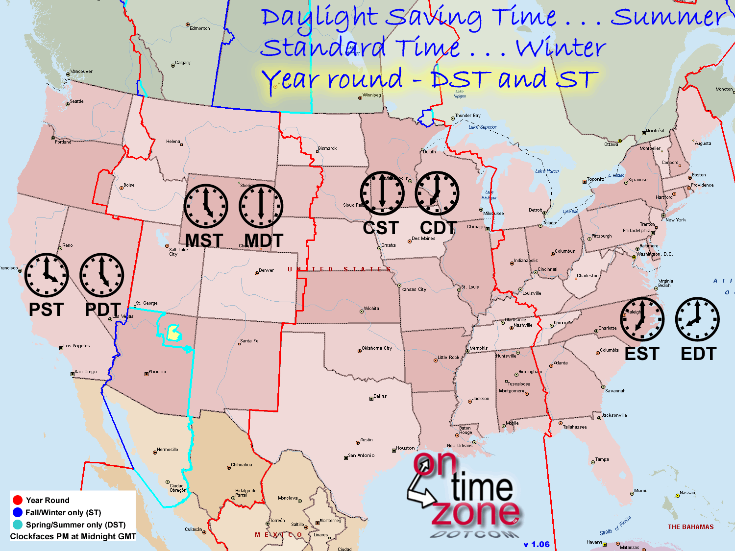
OnTimeZone.com provides North American time zone data for use in GPS, routing and mapping programs. This can be used in Garmin Basecamp, Garmin Mapsource, Google Maps, Google Earth Microsoft Streets and Trips, and any other software that accepts standard map data. Data and images are all available via the "Files/Downloads" button on the left navigation bar. OnTimeZone.com data is limited to North America, including time zone data for the United States, Canada, Mexico, Belize, Guatemala, El Salvador, Honduras, Nicaragua, Costa Rica and Panama. We include local exceptions to time zone observance, including Daylight Saving time rules. Time zone maps are often wrong, because time zone borders and exceptions change periodically. We track all such changes and make sure we are current *. Official changes in US time zone borders were made as recently as November 2010. Wherever there is a difference between official time zone data, and local time zone observance, we try to show both. (More on that in our "exceptions" page). We intend to keep the data current *. In our change log you will see that we keep very current with any changes to North American time zone borders and observance. The borders presented here includes recent changes in Indiana, North Dakota and Nayarit Mexico. All official changes up to 2017 are included. Then there's Daylight Saving Time. While most of the North America observes DST, there are significant exceptions. Such as Arizona (except for the Navajo reservation), Hawaii, the Mexican state of Sonora, the Canadian province of Saskatchewan, parts of eastern Quebec, and several smaller entities. Details in the "exceptions" page. Just like time zone deviations, some DST exceptions are official while others are merely local practice. So be warned. Hopefully this all helps get you where you need to go on time. * [Updates stopped in 2017. Depending on the intended use, we may be open to selling the domain.] Acknowledgements, Credits and Thanks  © 2010-2026 Steve Jones. All Rights Reserved. DISCLAIMER: All content was generated via human effort. Every attempt is made to ensure accuracy, and any errors detected or reported are corrected. But it is not possible to guarantee 100% accuracy. Therefore the contents of this site are not suitable for any use involving risk to health, finances or property. DO NOT ASSUME ONTIME ZONE BORDERS REFLECT POLITICAL BOUNDARIES. Some political boundaries are complex, with conflicting sources of data and possible ongoing disputes. This is especially true of many Native American lands. OTZ boundaries seek only to show the likely time at a given location, not to indicate anything about the local legal or political authority. Travelers should use other resources to remain mindful of their location when near international boundaries or those of soverign entities, especially those which may be poorly marked or follow geographic features. Though donations are welcome and appreciated, the contents of OnTimeZone.com are unrestricted for any private, non-commercial use. It can be licensed for commercial and government use, contact us at the email address above for details. All rights to content from OnTimeZone.com (files, data, artwork, webpages) are reserved. Content may not be published elsewhere or used for any commercial or governmental purpose without explicit written permission. |
||||
|